
Please be advised of the following:
Please be advised the conservation advice package for Wyville Thomson Ridge was published on 29 May 2026. This is JNCC’s formal conservation advice for the site and can be accessed via the conservation advice section of this Site Information Centre.
Please note that the structure of this conservation advice package has been revised to support ease of access and understanding for users. More detail is provided in the conservation advice section below.
As of 16 October 2025, new fisheries measures are in force for Wyville Thomson Ridge SAC. The fisheries measures for this site are demersal mobile gear prohibited from one zoned area. Demersal mobile gear and demersal static gear prohibited in one zoned area. For more information about these fisheries measures please see 'Offshore Marine Protected Areas – fisheries management measures: supporting guidance on coordinates and restrictions' on the Scottish Government website. Updated conservation advice will be provided in due course.
Status: Special Area of Conservation (SAC)
The Wyville Thomson Ridge is a rocky plateau situated in the Atlantic Ocean to the north-eastern part of the Rockall Trough.
Site
Situated in the Atlantic Ocean to the north-eastern part of the Rockall Trough, The Wyville Thomson Ridge is a rocky plateau.
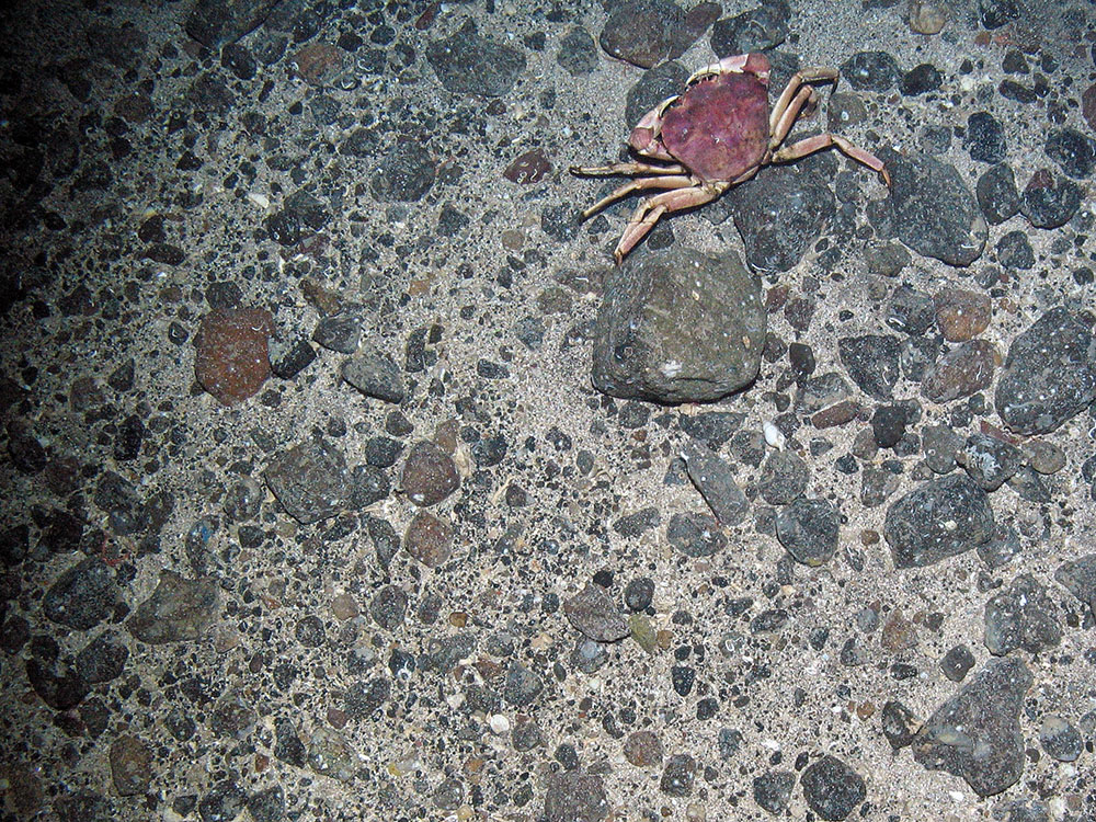
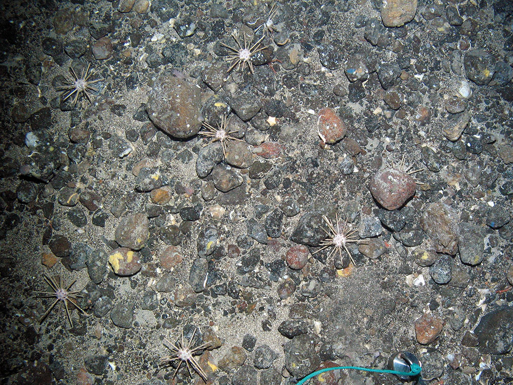
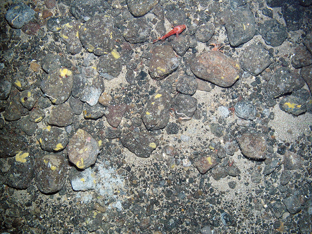
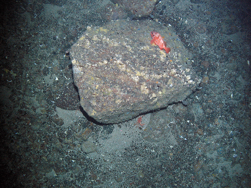
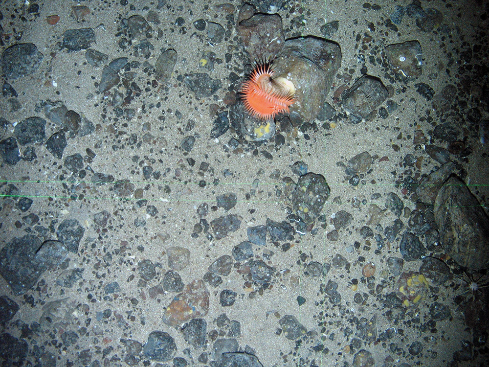
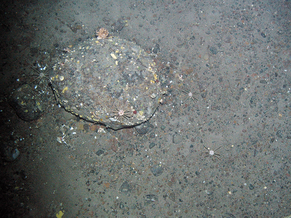
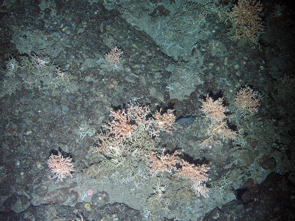
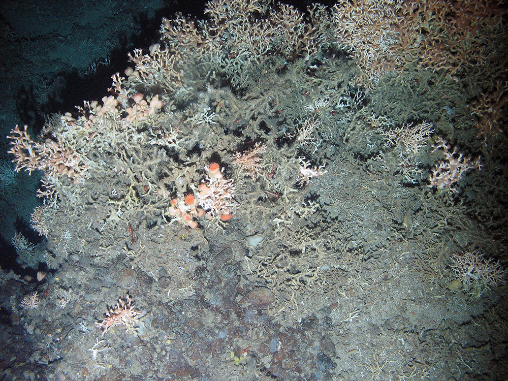
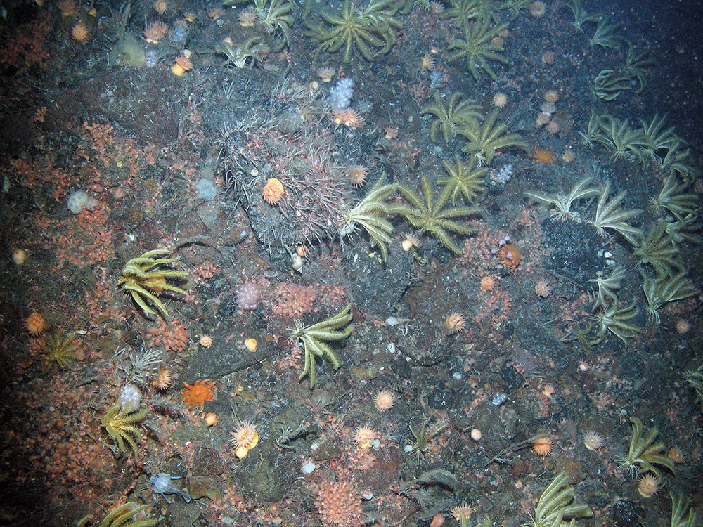
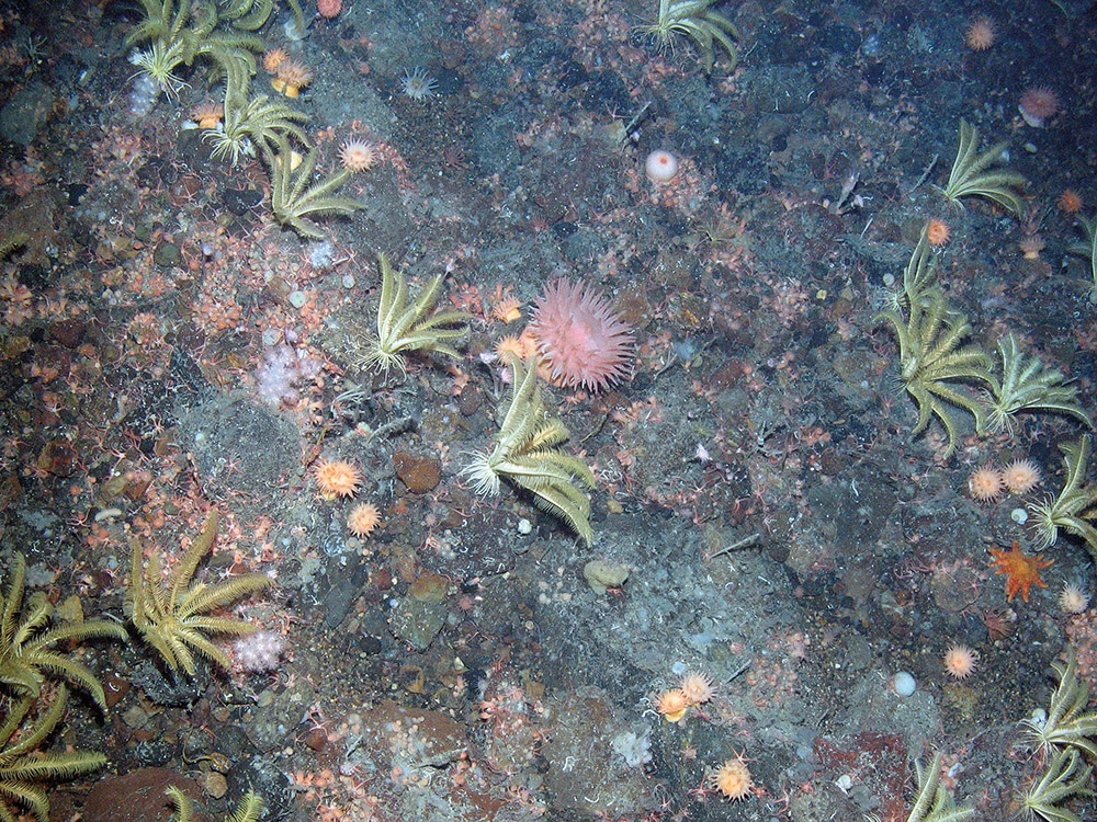
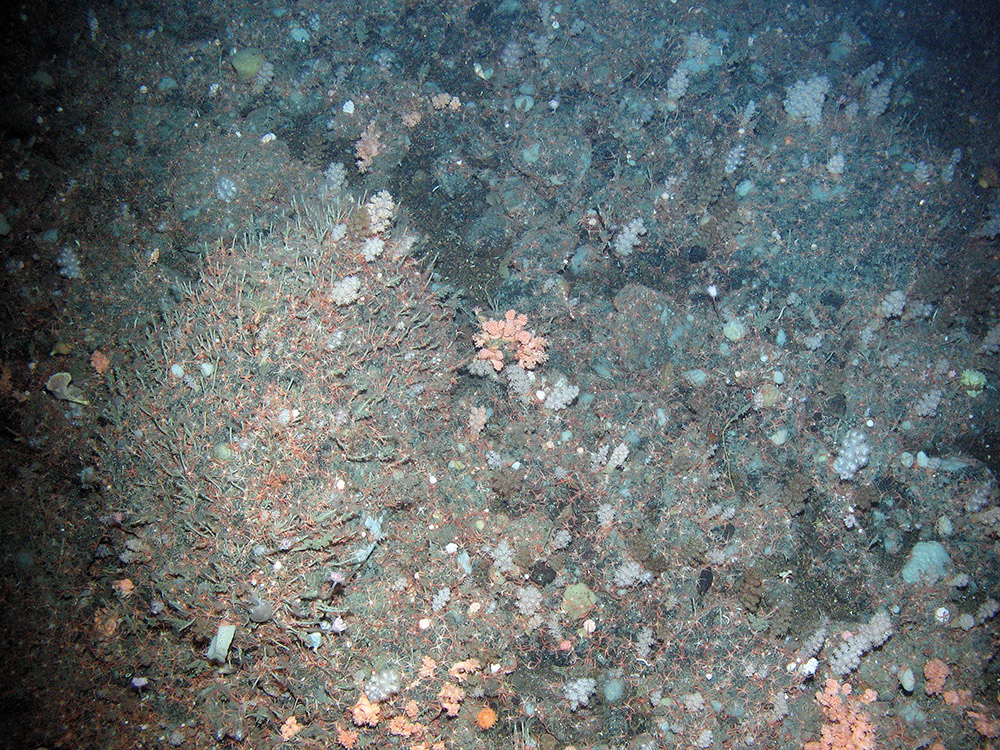
It is composed of extensive areas of stony reef interspersed with gravel areas and bedrock reef along its flanks, and supports diverse biological communities representative of hard substratum in deep water including a range of sponges; stylasterid, cup and soft corals; brachiopods; bryozoans; dense beds of featherstars and brittlestars; sea urchins, sea cucumbers and sea spiders. The stony reef is thought to have been formed by the ploughing movement of icebergs through the seabed at the end of the last ice age.
More detailed site information can be found in the Summary section below.
Map displaying the Wyville Thomson Ridge MPA boundary and associated protected feature data. Visit JNCC's MPA Mapper to further view and explore data for this MPA.
Legislation
Legislation behind the designation: EU Habitats Directive 1992 transposed into UK law by The Conservation of Offshore Marine Habitats and Species Regulations 2017 (as amended).
Protected Features
| Feature | Feature Type |
| 1170 Reefs | Annex 1 Habitat |
Specific information on the conservation objectives relating to this site is provided in the Conservation Advice section.
The acquisition of new data may result in updates to our knowledge on feature presence and extent within this site. The most up-to-date information is reflected on the map on this page and in JNCC’s MPA Mapper, and the evidence underpinning this can be viewed in the Monitoring and Evidence section.
Site Timeline
The diagram below is a summary of the key milestones involved in the selection and designation of Wyville Thomson Ridge SAC. More detail can be found within the Relevant Documentation section.
Relevant Documentation
The documents referred to below and any other historical documents relating to the Wyville Thomson Ridge SAC were produced during the selection and designation process and therefore may be out of date. This Site Information Centre is the most up-to-date source of information for this MPA, and will reflect any additional information gathered since these documents were produced. Information about the SAC site selection process is available on JNCC's SAC webpages.
- Standard Data Form – Details the SAC and the designated features.
- SAC Selection Assessment Document – Overview of the SAC, designated features and rationale for site selection.
- Post-consultation Report and Impact Assessment – Overview of the consultation outcomes, and an assessment of the environmental, social and economic costs and benefits of the designation.
- Management Options Paper – Considers the management options for achieving the conservation objective for the protected feature in the MPA.
- JNCC's formal conservation advice for this site is accessible through the Conservation Advice section.
These resources are available on JNCC's Resource Hub.
Summary
Last updated: October 2017
The information for this site summary was adapted from documents listed in the Relevant Documentation section and incorporates any further information gathered since these documents were produced.
Site overview
The Wyville Thomson Ridge is located on the Scottish continental shelf edge approximately 150 km north-west of Cape Wrath, and extends in a north-westerly direction towards the Faeroe Bank. The Ridge divides the relatively warmer waters of the Rockall Trough from the relatively cooler waters of the Faroe-Shetland Channel, and is a transitional area between the two water masses.
The Wyville Thomson Ridge is approximately 20 km wide and 70 km long and rises from over 1,000 m depth to less than 400 m at the summit. The ridge is composed of extensive areas of stony reef interspersed with gravel areas and bedrock reef along its flanks. The stony reef is thought to have been formed by the ploughing movement of icebergs through the seabed at the end of the last ice age. These iceberg 'ploughmarks' consist of ridges of boulders, cobbles and gravel where finer sediments have been winnowed away by high-energy currents at the site, interspersed with finer sediment troughs up to 10m deep.
The rock and stony reef areas in the site support diverse biological communities representative of hard substratum in deep water, including a range of sponges; stylasterid, cup and soft corals; brachiopods; bryozoans; dense beds of featherstars and brittlestars; sea urchins, sea cucumbers and sea spiders. Communities on the bedrock reef vary in species composition between the two sides of the ridge due to the influences of different water masses. This combination of water masses in one area is unique in UK waters. Further detail on the evidence for this SAC can be found in the Monitoring and Evidence section.
Site location: Co-ordinates for this SAC can be found in the Standard Data Form listed in the Relevant Documentation section.
Site area: This site has an area of 1,740 km2, slightly larger than the neighbouring Shetland Isles.
Site depth range: The site is on a ridge at the edge of the continental shelf, sitting at 310 m, sloping down to its deepest at 1,010 m below sea-level.
Charting Progress 2 Biogeographic Region: The MPA spans the boundary between the Atlantic North-West Approaches, Rockall Trough and Faeroe/Shetland Channel region and the Scottish Continental Shelf region.
Site boundary description: The boundary for the Wyville Thomson Ridge SAC is a simple polygon defined by whole degrees and minutes, fully enclosing the minimum area necessary to ensure protection of the Annex I reef of the site. Bottom trawling is a threat to the reef and, therefore, the proposed boundary includes a margin to allow for mobile gear on the seabed being at some distance from the location of a vessel at the sea surface.
Monitoring and Evidence
Last updated: January 2026
There are a range of data that underpin this SAC. The full overview of the data used to support site identification, along with information on confidence in feature presence and extent is available in the Wyville Thomson Ridge MPA SAC Selection Assessment Document. JNCC will be adding relevant survey data for this MPA to its MPA Mapper in due course.
Some of the data for this SAC have been collected through JNCC-funded or collaborative surveys, and some through other means. Data from these surveys provide direct evidence confirming the presence of the protected features within the site.
Survey and data gathering
- JNCC/SGMD Partnership Report 4: Wyville Thomson Ridge Special Area of Conservation Monitoring Report (2025) – JNCC and the Scottish Government’s Marine Directorate completed surveys 1517S and 1218S in 2017 and 2018 to collect imagery and video data to characterise the benthic communities at the MPA. This monitoring report primarily explores the data acquired from these first two surveys. This data will form the first point in a benthic monitoring time series at WTR.
- 1517S Cruise Report: Monitoring survey of North-east Faroe Shetland Channel Natural Conservation MPA, Wyville Thomson Ridge SAC & West Shetland Shelf Nature Conservation MPA (2019) – The aim of the 1517S survey was to gather initial data for a site monitoring time-series for NEF, WTR and WSS. The survey gathered evidence to inform assessment of the condition of the protected features of the site for comparison against future data to monitor the rate and direction of any changes. This will allow assessment of the long-term effectiveness of current proposed management measures.
- 1218S Cruise Report: Monitoring survey of Faroe-Shetland Sponge Belt Nature Conservation MPA, Rosemary Bank Seamount Nature Conservation MPA and Wyville Thomson Ridge SAC (2019) – The aims of the 1218S survey were to gather initial data for site condition monitoring time-series at Faroe-Shetland Sponge Belt NCMPA and Wyville Thomson Ridge SAC, and to gather data to better characterise the communities and habitats at Rosemary Bank Seamount NCMPA, to help inform future Marine Protected Area monitoring efforts at this site.
- Monitoring survey of Wyville Thomson Ridge SAC (2017) – JNCC and Marine Scotland Science undertook a survey of three Scottish MPAs, including Wyville Thomson Ridge SAC. Fifteen video tows were collected over the iceberg ploughmark fields within the site to inform monitoring of the protected Annex I reefs.
- Deep Links Project (2016) – A collaborative project between Plymouth University's Deep Sea CRU and University of Oxford, in partnership with JNCC and British Geological Survey, funded by NERC. During May and June 2016 the team undertook a 6 week research cruise in the North East Atlantic, including Wyville Thomson Ridge, on board the RRS James Cook collecting data. This project aims to investigate the theory that populations at bathyal depths are more isolated because the currents that transport larvae decrease with depth.
- Wyville Thomson Ridge and Faroe-Shetland Channel Survey (2012) – This survey was a collaboration between JNCC and Marine Scotland Science. Video and camera imagery were collected to support evidence on the presence and extent of the Annex I reef feature of the Wyville Thomson Ridge.
- Strategic Environmental Assessment (SEA) Survey 7 (2006) – This survey was commissioned by the Department for Trade and Industry (now Department for Energy and Climate Change (DECC)), as part of the Strategic Environmental Assessment (SEA) survey programme. This survey aboard the commercial research vessel Franklin, in which JNCC collaborated, collected acoustic and underwater imagery data from areas off the north and west coasts of Scotland including the Wyville Thomson Ridge.
- Atlantic Frontier Environmental Network (AFEN) (1996–2000) – Southampton’s National Oceanography Centre undertook large-scale sampling of the shelf edge and slope west of Shetland on behalf of the Department for Transport and Industry (now the Department for Energy and Climate Change) on a series of surveys undertaken between 1996 and 2000. These surveys, in which JNCC collaborated, helped characterise the geology, geomorphology and fauna on the Wyville Thomson Ridge.
- Towed Ocean Bottom Instrument (TOBI) surveys of the continental slope west of Shetland (1996/1998) – The National Oceanographic Centre (NOC) used side-scan sonar amongst other sampling methods to undertake a baseline environmental survey of the seafloor on the continental slope west of Shetland. This included the collection of extensive side-scan sonar data at the Wyville Thomson Ridge.
Data analysis reports
- Analysis of video and still images to characterise habitats and macrobenthos of the Wyville Thomson Ridge SAC and Faroe-Shetland Sponge Belt Scottish Nature Conservation MPA (2014) – Marine EcoSol were contracted by JNCC to analyse data from the 2012 survey of the Wyville Thomson Ridge and Faroe-Shetland Sponge Belt. The report confirmed the presence of Annex I reef in some locations on the Wyville Thomson Ridge where sampling took place.
- Seafloor biotope analysis of the deep waters of the SEA4 region (2012) – Data from this site were included in a contract to identify, map and describe the seabed biotopes of the SEA4 region of Scottish seas.
- Photographic analysis report of the SEA Survey (2006) – Analysis of the images from the 2006 Strategic Environmental Assessment Survey. The results support the presence of Annex I reef within the Wyville Thomson Ridge – including cold-water corals.
- UK Atlantic margin environmental survey: introduction and overview of bathyal benthic ecology (2001) – Published in Continental Shelf Research, 21, (8/10), 917–956. This scientific paper by Brian Bett presents the collective analysis of data collected through the Atlantic Frontier Environmental Network surveys, including those that undertook sampling of the Wyville Thomson Ridge.
Additional relevant literature
References for further supporting scientific literature consulted during the identification of this site can be found in the Wyville Thomson Ridge SAC Selection Assessment Document. Please be aware that although these sources contain information in relation to this MPA, they do not necessarily represent the views of JNCC.
Knowledge gaps
As part of the UK Marine Monitoring and Assessment Strategy (UKMMAS), JNCC led the development of a UK Marine Biodiversity Monitoring Strategy, working with partners across the UK monitoring community. The Strategy spans UK territorial and offshore waters, focusing on biodiversity in the wider environment and within Marine Protected Areas. Its aim is to implement efficient, integrated monitoring of marine biodiversity to provide the evidence needed for all the UK's policy drivers.
The Marine Directorate of Scottish Government, in partnership with JNCC and NatureScot, developed a Scottish Marine Protected Area (MPA) monitoring strategy. The Strategy spans Scottish territorial and offshore waters, focusing on biodiversity within Marine Protected Areas. The Strategy is supported by a series of annexes which provide more detail on monitoring methods, collaborative working, current monitoring and a two year forward look for MPA monitoring in Scottish waters.
The evidence collected during MPA monitoring surveys is used in combination with other available evidence to:
- Enable assessment of condition of the features within sites;
- Contribute to the assessment of the degree to which management measures are effective in achieving the conservation objectives for the protected features;
- Support the identification of priorities for future protection and/or management; and,
- Enable Government to fulfil its national and international assessment and reporting commitments in relation to MPAs and help identify where further action may be required.
More detail on offshore MPA monitoring can be found on the Offshore MPA monitoring webpage. A list of monitoring surveys and relevant reports can be found on the MPA monitoring survey reports webpage.
If you are aware of any additional information not referred to here or in the Relevant Documentation section, please contact us.
Conservation Advice
Last updated: May 2026
Further information on the approach used to develop this advice is available on our ‘Conserving MPAs’ webpage along with a Glossary of Terms used in JNCC conservation advice to support the use of the conservation advice packages.
You must refer to the conservation advice package for a SAC if you are:
- intending to carry out any licensed activity in or near a SAC and need to find out how to operate within the law;
- an authority providing advice on specific proposals;
- an authority responsible for putting management measures in place.
You may also find it useful to refer to the conservation advice package for a SAC if you are intending to carry out an activity in or near a SAC that does not require a license.
Note JNCC’s conservation advice has undergone development and a restructure in 2025 resulting in some changes it is useful to be aware of. Amongst other changes, most notably, there are now only four documents instead of five, having merged the content previously presented in two separate documents (i.e. the Conservation Objectives and Conservation Advice Statements) into one, now called the Conservation Objectives and Management Advice document.
We will engage with stakeholders to identify any lessons which JNCC can learn from customers who have used the advice, with a view to continuing to ensure it is fit-for-purpose.
The following table provides an overview of the components of the conservation advice and provides hyperlinks to each. Combined, these components form JNCC's formal conservation advice for this site and should be read in conjunction with each other. Until such times as this advice is updated, it remains JNCC's formal conservation advice for the site
| Document | Overview |
|---|---|
| Background Information | Explains where to find the advice package, JNCC’s role in the provision of conservation advice, how the advice has been prepared, when to refer to it and how it can be used. |
|
Conservation Objectives and Management Advice
|
Sets out the broad ecological aims (conservation objectives) for the site, JNCC’s view of qualifying feature condition, the conservation benefits that the site can provide if managed effectively, and the conservation measures which JNCC considers are required to support achievement of the conservation objectives stated for the site. |
| Supplementary Advice on Conservation Advice (SACO) |
Provides more detailed and site-specific information and is essential reading to support the interpretation of the conservation objectives for the qualifying features of the site. Use this document to assess the impacts of your planned activity on the important attributes of the site. |
| Advice on Operations |
Provides information in an Excel workbook on the activities capable of impacting the site’s qualifying features and therefore achievement of the site’s conservation objectives. This is a starting point for determining potential management requirements. It does not take into account the intensity, frequency or cumulative impacts from activities taking place. It simply supports an understanding of the possible adverse impacts that an activity can have on a MPA’s features. Guidance is imbedded to support an understanding and use of the information provided in the workbook. Use the Advice on Operations document to determine those pressures an activity can cause that could harm the qualifying/protected features of the site. |
These resources are available on JNCC's Resource Hub.
Image Gallery


Published: